This webpage is not updated over the weekend/overnight. For up-to-date information on traffic impacts, visit 511mn.org.
About this project
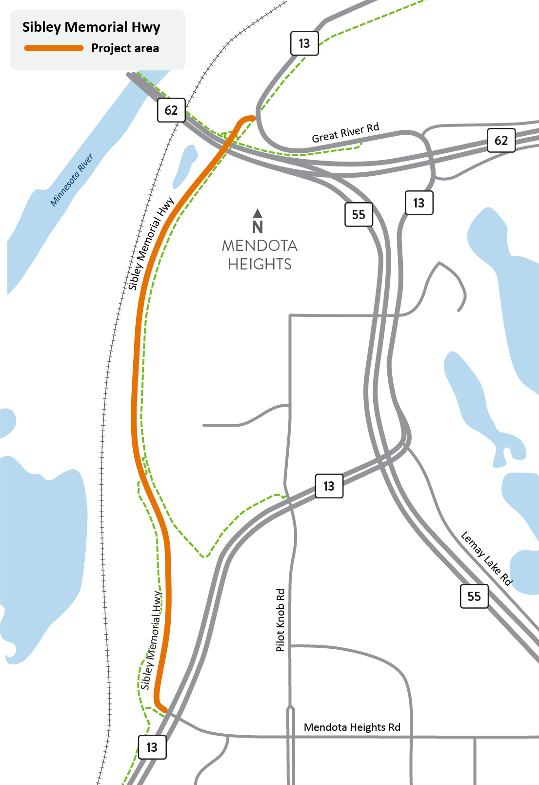
View full-size map
In coordination with the city of Mendota Heights, we will repave Sibley Memorial Hwy between the south intersection with Hwy 13/Mendota Heights Rd. and the north intersection with Hwy 13/Great River Rd. just north of Hwy 55.
This section of the road is part of an old alignment of Hwy 13 and is no longer needed on MnDOT's highway system. Before we transfer ownership to the city of Mendota Heights, we need to make repairs to the pavement, drainage, and replace the pedestrian ramps throughout the project area in order to meet current Americans with Disabilities Act (ADA) standards to improve both safety and accessibility for all users. Once crews complete the repairs or updates, we will transfer the ownership of Sibley Memorial Hwy to the city of Mendota Heights to support their local control and future planning.
During construction there will be impacts on the eastern boundary of Fort Snelling State Park that will require a brief closure and detour of a small portion of Big Rivers Regional Trail near the intersection of Sibley Memorial Hwy and Perron Rd. We provided a public notice and opportunity for comment on the project through a newspaper publication on Nov. 21, 2025 and in-person viewing from Nov. 21 through Dec. 5, 2025.
Summary of work
- Repave Sibley Memorial Hwy between the south intersection with Mendota Heights Rd. and the north intersection with Great River Rd.
- Replace drainage culverts
- Repair erosion
- Construct maintenance access road
- Improve ADA pedestrian ramps
Traffic impacts
All traffic impacts are tentative and weather dependent.
Upcoming
Information about upcoming traffic impacts will be provided as details become available.